

The typical margin of error for standard consumer devices is about 16 feet under an open sky, though gps tracking accuracy changes significantly based on your immediate environment and what affects performance. Most of the time, the biggest issue is signal blockage from large structures or dense tree cover. You can confirm your current error margin by checking the “accuracy radius” displayed on your navigation app. If the number is high, your device is likely struggling to lock onto enough satellites to triangulate your position.
How tracking performance affects accuracy
Signal degradation occurs when the environment interferes with the line-of-sight connection between your receiver and the satellites. The following table ranks the most frequent causes of poor performance and how you can identify them.
| Cause | How common | How to confirm it | Fix it yourself? |
|---|---|---|---|
| Tall buildings | Very common | Signal drops in cities | Move to open area |
| Dense tree cover | Common | Accuracy radius increases | Change your location |
| Bad weather | Occasional | Signal fluctuates in rain | Wait for clear skies |
| Low battery | Occasional | Device performance slows | Charge your battery |
| Hardware damage | Rare | Signal never locks | No |
| Software bugs | Rare | Device freezes or lags | Yes, with care |
Urban canyons represent the most significant obstacle. When your device loses connection in a city, the signal is likely bouncing off glass or steel surfaces, a phenomenon known as multipath interference. If your coordinates jump by more than 50 meters while you’re standing still, you’re experiencing this reflection. Move at least 20 meters away from the nearest high-rise to clear the obstruction.
Dense canopy cover creates a different problem. Unlike buildings, leaves absorb signal energy rather than reflecting it. If your accuracy radius exceeds 10 meters in a forest, the device is struggling to maintain a lock on the minimum of four satellites required for a fix. Step into a clearing or a trail gap to restore connectivity.
Many users mistake a low battery for a hardware failure. When your power level drops below 15 percent, the processor often throttles its background tasks to conserve energy, which delays signal acquisition. Always check your battery status before assuming a component has failed. If the device remains unresponsive after a full charge, perform a factory reset to rule out corrupted cache files. If the signal still fails to lock in an open field, the internal antenna is likely compromised.
Urban canyons and signal reflection
Urban canyons occur when skyscrapers reflect satellite signals before they reach your device. This phenomenon, known as multipath interference, causes the receiver to calculate a false distance because the signal traveled a longer path after bouncing off a glass or concrete surface. You’ll notice this when your blue dot on a map jumps suddenly between streets or shows you on the wrong side of a building.
Modern receivers attempt to filter these reflections using signal strength thresholds, but dense glass facades create echoes nearly as strong as direct signals. The processor can’t distinguish the bounce from the true line of sight in these specific conditions. Expect positional errors ranging from fifteen to fifty meters perpendicular to the street alignment during peak reflection events.
To test if your environment is the cause, step away from tall buildings toward a wider intersection or park. If your position stabilizes within 30 to 60 seconds of reaching an open area, the buildings were blocking or reflecting your signal. This assumes you use a standard handheld device rather than professional survey equipment requiring longer re-acquisition times for high-quality locks.
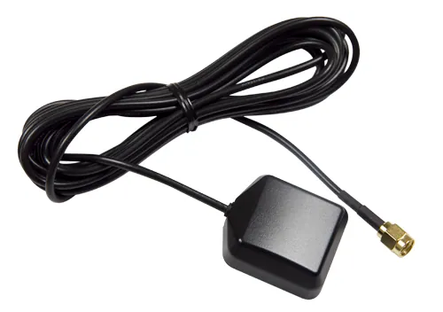
If your device remains erratic even in open spaces, check for physical obstructions on the antenna. A mistake people often make is placing their tracker inside a metal bag or deep pocket, which acts as a shield against incoming signals. This costs you precision and can lead to complete lock loss. Ensure external antenna connections are tight and cables remain free of pinches or sharp bends.
Enable raw measurement logging if your navigation app supports it to diagnose persistent urban canyon issues. Reviewing signal-to-noise ratios reveals whether specific satellites consistently produce degraded data in certain corridors. Disable those particular satellites manually in advanced settings to prevent them from corrupting your position solution with reflected measurements that bypass standard filtering algorithms.
Atmospheric and weather interference
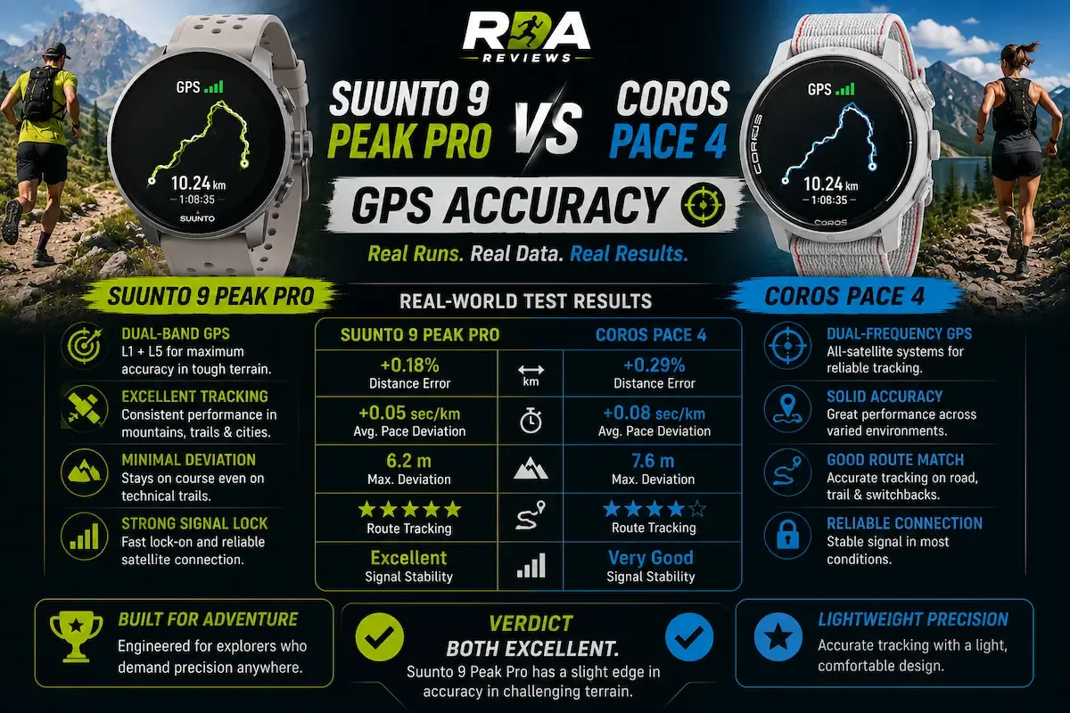
Signals from satellites must pass through the ionosphere and the troposphere to reach your receiver. According to the official information from the U.S. government, atmospheric conditions can delay signal travel time and introduce errors into the position calculation. Heavy rain, snow, or intense solar activity can scatter the radio waves, which reduces the number of satellites your device can “see” at one time.
You can tell if the weather is the culprit by monitoring the satellite signal strength bars on your device. If these bars are consistently lower than usual during a storm, the atmosphere is likely absorbing or scattering the signal.
If you’re in a location with clear skies and the bars remain low, check your device settings to ensure you aren’t in a power-saving mode. Power-saving settings often reduce the frequency of location updates to preserve battery, which makes your path look jagged or inaccurate.
This isn’t for users who need centimeter-level precision for professional land surveying. If you require that level of detail, you must use a differential GPS system that uses a ground-based reference station to correct atmospheric errors. For an ordinary user, the standard error of a few meters is usually acceptable. If you’re using a device in a remote area, always carry a backup map, as extreme solar flares can occasionally impact satellite signal integrity globally.
Limitations of hardware and software
Hardware limitations often prevent a device from utilizing all available satellite constellations, such as GLONASS or Galileo. Older hardware may only track the original GPS constellation, which limits the number of available signals in deep valleys or narrow streets.
If your device is significantly aged, it likely lacks the processing power to filter out reflected signals effectively. This creates a “multipath” error where the device interprets signals bouncing off buildings as direct line-of-sight data, often shifting your position by thirty feet or more.
Software issues can also create the appearance of poor accuracy. If your device is running outdated firmware, it may struggle to interpret the signal data correctly. You should check the manufacturer’s website to see if a firmware update is available for your specific model.
Applying an update can sometimes improve the algorithm the device uses to smooth out your path, especially when walking at slow speeds. Many users mistakenly assume their hardware is broken when a simple patch to the signal-processing logic would resolve the drift.
The limit for accuracy is determined by the number of satellites in your current view. If you can see fewer than four satellites, your device can’t calculate a 3D position at all. You can usually view the number of active satellites in the “satellite status” or “GPS diagnostics” menu of your device.
If you see fewer than four, you have reached the physical limit of the system in that location. If you see six or more but still experience errors, the problem isn’t your signal strength; it’s the geometry of the satellites, which are likely clustered too closely together in the sky to provide a reliable fix.
Rare causes of inaccurate tracking
Electromagnetic interference from high-voltage power lines or industrial radio towers can overwhelm weak satellite signals. If your path takes you near these structures, move at least 50 feet away to regain a clean lock.
Thick metal cases act as a Faraday cage, blocking the signal path entirely. If your tracking fails while the device is enclosed, remove the case immediately. Plastic or silicone covers are the only reliable options for consistent signal penetration.
Internal sensor drift often occurs after a significant drop or long-term magnetic exposure. When the compass or accelerometer misaligns, your device reports erratic movement or phantom detours. Navigate to your settings menu to perform a manual recalibration; if the device fails to stabilize after three attempts, the internal gyroscope is likely failing.
Hardware damage is the most common reason for total signal loss in a clear, open environment. If the antenna connection snaps due to impact, the unit can’t distinguish between a weak signal and a total absence of data. You can diagnose this by comparing your device against a secondary tracker in the same location. If the second device locks instantly while yours remains stuck on “searching,” the antenna is physically compromised.
Most users mistake a failing battery for signal loss. If your device struggles to maintain a lock only when the charge drops below 20%, the voltage output is insufficient to power the GPS module. Always keep your device above this threshold to ensure accuracy.
What is required to fix tracking errors
Fixing poor tracking accuracy usually demands a mix of time, better positioning, and occasional device maintenance. Most of the time, you simply need to move to a location with a clearer view of the sky, which costs you nothing but a few minutes of walking. If the issue is due to a software bug, downloading an update is a simple process that takes about as much time as a standard app download.
When the cause is hardware damage, the fix is much more involved. Replacing an antenna or a faulty receiver board is like replacing the engine in a car: it’s expensive, requires specialized tools, and is best left to a professional. Before you commit to a repair, check your device’s warranty status or the official support page for your model.
If you’re uncertain about the cost of a repair, contact the manufacturer directly to get a quote based on your specific serial number. Never try to open the device yourself, as this often voids your warranty and can cause permanent damage to the sensitive internal components.
To determine if your problem is environmental or mechanical, look at the signal strength indicator. If your device shows a strong signal but still reports the wrong location, you’re likely dealing with multipath interference caused by tall buildings or dense foliage. In this case, moving just fifty feet away from the obstruction will resolve the error. If the signal remains consistently at zero or fails to lock onto any satellites regardless of your location, the internal hardware has likely failed.
Most users mistakenly assume a factory reset will fix a hardware failure. This rarely works and only forces you to spend an hour reconfiguring your settings. If the hardware is truly broken, a reset only adds frustration to the inevitable repair bill.
Related guides